5:38
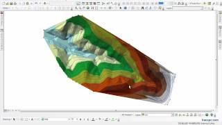
Creating Digital Elevation Models from vector data
GisGeographer
3:24
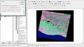
COMPOSICION DE BANDAS SATELITALES LANDSAT ETM+ EN ARCGIS 9.3
Ludvin Garcia
3:55
Extract by mask ArcGis
3:04
How to Make a Layout in ArcMap
UTMLibrary
11:15
¿Cómo crear un mapa de pendientes en ArcGIS 10?
El blog de franz
1:20
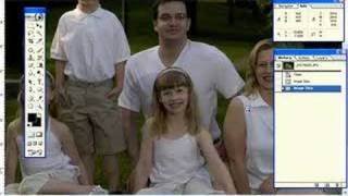
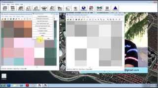
How to adjust DPI in Photoshop
lebsockk00@gmail.com
2:31
DPI Explained
Robert Provencher
7:16
How to change the resolution of a photo in Photoshop
Design Like a Pro
26:17
Curso práctico básico de ArcGIS 10
9:55
making maps with ArcGIS Arcmap (part three): shape-files
Riccardo Klinger (Digital Geography)
9:07
Folds, Dip and Strike
wvannorden
1:12
Extract Raster Values to Shapefile in ArcMap
GISTutorials
4:29
Clipping Raster Dataset in ArcGIS 10
nasa2011reu
1:00:15
What's New in ArcGIS 9 Labeling and Annotation
Mahmoud Abdelrahman
2:10
Tutorial ARCGIS Capitulo 10-06 ArcScene: Simbología lineal especial 3D
Rodolfo Franco
1:50
ArcGIS connecting to BGS Web Map Service for onshore geology maps 1:50 000 scale tutorial
British Geological Survey
5:19
Split Out and Reclassify
geospatialops
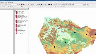
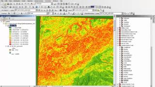
19:10
analysis of a digital elevation model in ArcMAP
4:31
Localizar Create TIN from Features, Raster Calculator y otras herramientas ArcGIS 10
13:00
Georeferenciar imágenes con Global Mapper de Google Earth en alta calidad para ArcGis y Qgis 2015
GEO GPS PERÚ
20:32
Georeferenciación de foto google earth
M.I.A. Miguel Angel Mosqueda Lagunes
LIVE
[Private video]
7:38
Discover How You Can Download Google Earth Images In 7 Minutes
Morad Ouasti
10:08
Create Building for Google Earth with Photo Textures
Beryl Reid
4:22
How to remove clouds in erdas 2013...ماهر الورفلي شرح ازالة الغيوم برنامج الايرداس
MAHER ABURAS
6:43
PAN Sharpen (Resolution Merge) - Enhance Spatial Resolution of Image in ERDAS Imagine
Geo-Spatial Tutorials
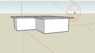
5:17
SketchUp: Constructing gabled roofs
aidanchopra
5:50
SketchUp: Creating eaves for buildings with pitched roofs
8:47
Как сделать балкон/How to make balcony in Google SketchUp
Артур Самойленко
5:01
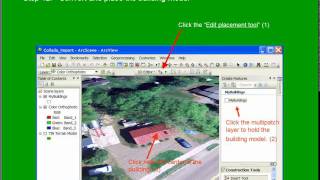
Converting SketchUp 8 models to ArcGIS 10 Multipatch features.
GISin3D
9:53
Google SketchUp to ArcGIS tutorial
alistairleak
10:40
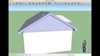
Build a roof in Sketchup
MaplesMedia
16:46
12 - Python Coding - Reading and Writing to Text Files using Lists - www ComputerScienceUK com
ComputerScienceUK
9:01
Import Garmin GPS coordinates into Arcmap
porestudiartanto
14:44
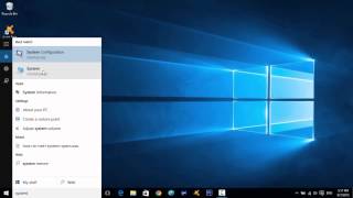
How to Make Your Computer Faster | Windows 10 Edition! | 200%+ Performance Boost
itsnucktime
13:13
How to check and remove virus from your computer without using any antivirus
Sandeep Singh
5:12
Harta energie de relief - ArcGiS
DoctorWhoR0
22:54
Curso de SketchUp - Aula 01/20 - Módulo Básico - Autocriativo
Ailton Brito
46:09
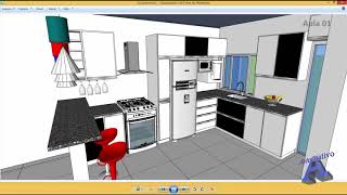
Make an Interior Design with Google Sketchup
AF Channel
8:19
How to Speed Up Your Windows 10 Performance (best settings)
Geeks Tutorial
2:52
Excel Magic Trick 1142: Get Every Other Row with Formula: INDEX and ROWS*2
excelisfun
6:39
Using gdal_translate to download WMS imagery...
Andres Oswaldo Calderon Romero
13:12
Flow Direction Flow Accumulation
Shea O'Neill
4:24
How To Capture Your Screen In 2015! (Screen Record On Windows 10)
Muaaz