ArcGIS QuickCapture
ArcGIS |
18 videos |
Updated 2 years ago
To learn more about ArcGIS QuickCapture visit: p.ctx.ly/r/9gst
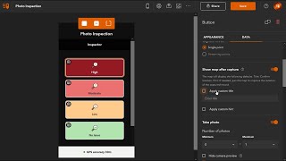
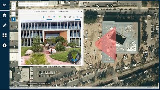
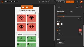
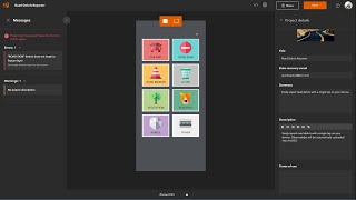
ArcGIS QuickCapture is the fastest way to collect field observations. With this simple app, you can quickly record field observations from a moving vehicle while you scout locations, conduct aerial surveys, or assess damage. Send data back to the office for analysis in real time and eliminate time spent manually processing handwritten notes. ArcGIS QuickCapture is integrated with ArcGIS, so new data from the field can be used instantly for better decision-making. Turbocharge your data collection workflows at speed with ArcGIS QuickCapture.