8:12
Cheaper alternatives to DroneDeploy and PIX4D (YDQA EP 29)
Drone Launch Academy
16:01
How To Create a 3D Model With Your Drone Using DJI Terra
Billy Kyle
8:20
DEM Editing Tools - Part 3 - Editing Bridges
CATALYST. Earth
22:16
Using WebODM to Process Drone Imagery (RTK or GCP) & Perform an Accuracy Assessment with QGis Part 2
Nathan J.B.
20:41
How to use GCPs for Drone Mapping?
Hammer Missions
1:05:22
Master LiDAR Data Processing (Full Walkthrough!)
Indiana Drones
21:58
Make VOX Style Maps in Adobe After Effects
Boone Loves Video
13:35
How to Create Map Animation like Dhruv Rathee | Vox | Johnny Harris in Geo Layers 3 Part 1 | EZEdit
EZEdit
24:59
Corrupt Cops Arrest Veteran And SERIOUSLY Regret It!
Audit the Audit
21:22
Using Potree Web Interface
IQ Center
13:52
Clean 3D Animated Travel Map Tutorial in After Effects
Ignace Aleya
29:29
How I Make My Maps
Johnny Harris
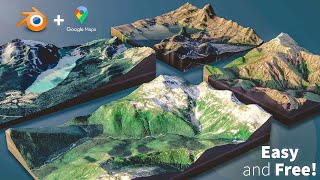
12:17
How to Create 3D Terrain with Google Maps and Blender!
CG Geek
28:42
CloudCompare Tutorial 01 - Opening files and basic navigation
James Dietrich
7:17
How to Quickly Align and Merge Two Point Clouds in CloudCompare
EveryPoint
18:13
The BEST Automated Drone Photogrammetry App! - UgCS
Dylan Gorman
ONE Trick to Improve Your Photogrammetry
Geospatial Tips
13:05
Sharing Maps and 3D Models using WebODM
Avios Media
22:32
Dronelink Advanced #07 - Mapping
Oyibo
23:36
Litchi vs. Dronelink. Battle of the Web Apps
24:34
Using QGis For Drone Flight Planning
Rich Charpentier
5:31
Agisoft Metashape Removing Water Object and Noise Pixels in a DEM
GEO 2004
1:40:09
Autocad - Complete tutorial for beginners (Full tutorial 1h40m)
CAD in black
8:56
PIX4D Vs. Agisoft Metashape-3D Modeling with Photogrammetry
GM6 Drone Mapping
1:04:55
Underwater Photogrammetry Tutorial - Agisoft Metashape - Capturing, Processing & Sharing Model
Dive Addicts
13:57
How to Create a 2D Map with Your Drone Using DroneDeploy
13:58
Reality Capture - Photogrammetry software