26:20
Introduction to GIS 4: What is a Census Tract? Tracts, Blocks and More
BurkeyAcademy
29:57
Lab 5 2011
UTGRG
24:59
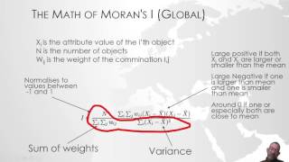
Hot Spot analysis using Moran's I and getis-ord statistics in ArcMap/ArcGIS
Geoinformatics
8:40
Download and Use Thematic Data Like Soil, Transportation, Weather Data etc from Online Resources
Geo-Spatial Tutorials
LIVE
[Private video]
9:25
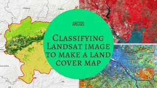
ARCGIS : Classifying Landsat image to make a land cover map
geomatika
18:57
Maximum Likelihood Supervised Classification using ArcGIS 10.4.1
Tania Banerjee
4:11
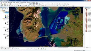
Creating and interpreting Urban false color image Landsat 8 ArcGIS
Made 4 Geek
5:32
Unsupervised Classification in Erdas Imagine Software
Rafiul
22:46
Calculating Land Surface Temperature Landsat8 by ArcGIS
7:10
ArcMap Surface Tools( Contour, Aspect, Slope, Hillshade)-izohips, bakı, eğim, kabartma
Emre Duman
13:25
Identifying Clusters 3 - Cluster Analysis with Polygon Features in ArcGIS 10.2
Marcos Luna
11:33
Spatial Interpolation and Density
DEEGSNCCU
1:22
Arcgis Arcmap Point Density
Totally Explained
5:56
ArcGIS Hotspot Analysis
GeoMattix GIS Training
10:44
Create Sequential Numbers in ArcGIS (without using = FID!!) Bangla - বাংলা
Md. Hossan
24:32
QGIS: Mosaico, Reprojeção e Substituição de Pixel no SRTM de 30m
Processamento Digital
7:01
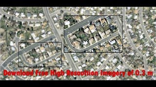
Download 0.3m High resolution Satellite Imagery for free
Terra Spatial
1:03:07
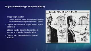
ArcGIS Pro: Image Segmentation, Classification and Machine Learning
Esri Events
1:02:49
Imagery in ArcGIS
33:24
Building a Smart County
6:24
INTRO: Geo Spatial Analysis in Urban Planning
IIT Kharagpur July 2018
4:52
Instalação do Orfeo (OTB) no QGIS
Hemerson Pistori
5:01
Radiometric and Atmospheric Correction in Envi
Sabri El Mouatassime
3:29
Remote Sensing in ArcGIS Tutorial 17: Change Detection Using Landsat Imagery
Virginia Geospatial Extension
1:00:41
TIME SERIES ANALYSIS AND PREDICTION USING IDRIS SELVA, CHANGE MODELLING,
Tesini Dombo
1:01:31
Building Your Professional GIS Portfolio (February 18, 2022)
Geospatial Professional Network (formerly URISA)