
 ERIS Info
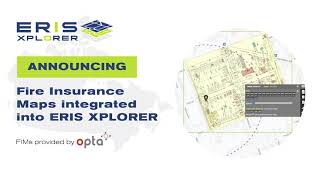
ERIS is a leading provider of environmental records, risk data & research for properties in the United States, Canada & Mexico. Our depth & variety of data, coupled with our innovative tools like ERIS XPLORER, our MOBILE app, & SCRIVA, make Phase I ESAs & other forms of environmental due diligence easier than ever. Xplorer allows you to visualize, interpret & analyze risk information related to a particular location. ERIS Mobile enables direct access to your ERIS project data on-site & facilitates the collection of info including photos, notes & checklists. SCRIVA, brings all your information together in an intuitive report authoring platform. ERIS database reports, physical setting reports, historical property information including fire insurance maps, aerial photos, topographic maps, city directories, land title searches, inspection reports & site plans are used by envl consultants, commercial developers, & lenders for real estate due diligence & commercial environmental planning.


Shared 1 month ago
117 views

Shared 2 months ago
48 views


Shared 5 months ago
41 views


Shared 6 months ago
44 views

Shared 6 months ago
41 views

Shared 8 months ago
27 views

Shared 8 months ago
5 views


Shared 11 months ago
13 views

Shared 1 year ago
12 views

Shared 1 year ago
86 views

Shared 1 year ago
53 views


Shared 1 year ago
8 views
Shared 1 year ago
32 views


Shared 1 year ago
69 views


Shared 1 year ago
50 views

Shared 1 year ago
77 views


Shared 1 year ago
35 views


Shared 1 year ago
53 views

Shared 1 year ago
74 views
Shared 1 year ago
81 views

Shared 2 years ago
76 views


Shared 2 years ago
106 views

Shared 2 years ago
317 views


Shared 2 years ago
100 views


Shared 3 years ago
202 views

Shared 3 years ago
70 views


Shared 3 years ago
89 views

Shared 3 years ago
88 views

Shared 3 years ago
70 views

Shared 3 years ago
113 views

Shared 3 years ago
99 views

Shared 3 years ago
128 views
