3:37
Create a Hypsometric Curve in QGIS, the fast way
Hans van der Kwast
2:59
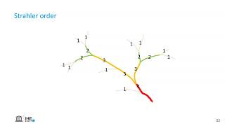
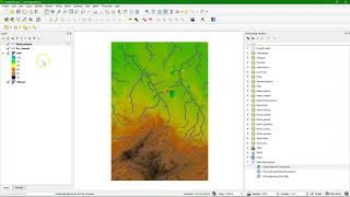
How to calculate Strahler orders in QGIS?
13:00
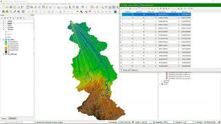
Calculate the Bifurcation Ratio of a stream network with QGIS
5:45
Calculate Drainage Density in QGIS
3:32
Use the Water Net Analyzer plugin to create a water network from a line vector in QGIS
10:57
Ranking stream orders in QGIS with the Lines Ranking plugin
7:01
Automating longest stream extracting using QGIS Graphical Modeller
7:11
Calculate longest distance from springs to outlet in a river network with QGIS
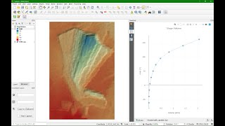
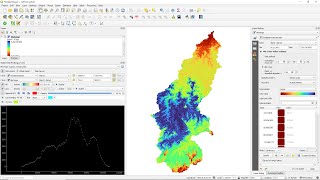
9:13
Create a Hypsometric Curve from a DEM using QGIS
7:24
Calculate time of concentration of a river in QGIS (Kirpich)
12:13
Create a stage volume curve with PyQGIS
3:29
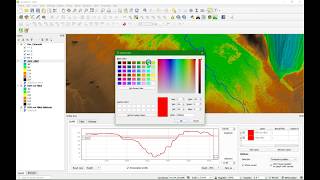
Create longitudinal river profiles using native QGIS tools
7:04
Longitudinal River Elevation Profiles in QGIS
3:34
Using the Profile Tool plugin in QGIS
6:32
Calculate the Topographic Wetness Index in QGIS
6:42
Calculate Basin Length in QGIS
16:03
Calculate a Unit Hydrograph from a DEM in QGIS
7:05
Calculate Height Above the Nearest Drainage (HAND) with QGIS using the PCRaster Tools Plugin
11:20
Calculate the Stream Power Index and Sediment Transport Index with PCRaster Tools in QGIS
3:18
Calculate Maximum Width and Length of a Catchment in QGIS
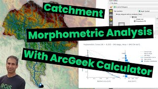
8:04
Catchment Morphometric Analysis in QGIS with the ArcGeek Calculator Plugin